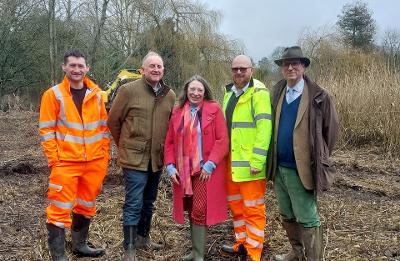
The Norfolk Strategic Flood Alliance deliver coordinated plan for Taverham Lane and Costessey Road
The Norfolk Strategic Flood Alliance (NSFA) has announced a coordinated programme of works to help reduce both the frequency and severity of flooding on Taverham Lane / Costessey Road. The route has historically been vulnerable during periods of extreme or prolonged rainfall, with several incidents where vehicles have left the road due to flood conditions.
A site visit in late 2025 confirmed that a historic ditch and culvert system — designed to allow water to move safely beneath the road — had become infilled and blocked. As a result, when the adjacent river overtops its bank during high flows, water currently has no route except across the road into the downstream floodplain.
To address this, partners have agreed a series of actions to restore the natural flow path:
- Reopening of the ditch system both upstream and downstream of the culvert beneath the road.
- The Water Management Alliance (WMA) will carry out this work, providing machinery, resources and necessary permits.
- Culvert clearance, with Anglian Water providing access, jetting equipment and staff to remove the blockage. Highways teams will then survey the structure to confirm its condition.
- Support from local landowners, including Anglian Water (west of the road) and a private landowner (east of the road), both of whom have agreed to the works.
Restoring the connection between the upstream and downstream floodplain will allow water to pass under the road during high flows rather than over it, reducing disruption and improving safety for drivers.
Alongside the recent Installation of marker boards which improve visibility of the road edge during flood conditions, highways crews from Norfolk County Council will also deliver:
- Verge works to improve residual drainage,
- Clearing of road gullies and sections of drainage north of the bridge, which currently contribute to minor flooding.
Councillor James Bensly Cabinet Member for Environment and Waste said "Flooding on this stretch of road has been a longstanding concern for local residents and drivers, so I'm really pleased to see partners working together to deliver a practical and lasting solution to reduce disruption and making this road significantly safer during periods of heavy rainfall. I'd like to thank all the organisations and landowners involved, this is a great example of what can be achieved when we partners take a joinedup approach."
Cllr Stuart Clancy, member for Taverham said "This stretch of road has caused concern for residents and road users for many years, so it's extremely positive to see such a coordinated effort to resolve the underlying issues. By restoring the historic drainage route and improving how the road copes with heavy rainfall, these works will make a real difference to people who rely on this route every day. I'm grateful to all the partners and landowners for their hard work and collaboration— it shows what can be achieved when everyone pulls in the same direction."
Looking further ahead, partners are exploring the feasibility of installing river level monitors, which could support long-term modelling and potentially link to roadside warning systems. This work remains at an early, exploratory stage.
Henry Cator, Chairman of the Norfolk Strategic Flood Alliance, said: "This project is a clear demonstration of what the NSFA was created to achieve. By bringing the right organisations together and taking a practical, wholesystem approach, we've made a real difference to the local community. I'm grateful to all partners for their goodwill, cooperation and commitment to getting this work underway. In particular the private landowner, without whom these improvements couldn't have been made"
All organisations involved are members of the NSFA. By working together and holding one another accountable for their respective actions, the partnership has delivered a realistic and coordinated plan to tackle the immediate issue of a blocked flow path while also paving the way for potential longterm improvements.
The NSFA emphasises that, given the location within a natural floodplain, flooding cannot be entirely prevented during extreme events. However, the planned works are expected to significantly reduce the impact and frequency of flooding and speed up the recovery of the road when it does occur. New road edge markers will also enhance driver safety during adverse conditions.
The NSFA would like to recognise that some partners are contributing beyond their formal responsibilities, which is a reflection of the shared determination to deliver the best possible outcome for the community.


